Feanwâlden - Garyp | Section 2 of the Bonifatius Kloosterpad Monastery Route
As you walk this second section of the Bonifatius Kloosterpad Monastery Route you can see how the monasteries helped shape the Frisian landscape.
The monks drained the water from the polders so the land could be reclaimed. Working together with local communities, the monasteries devised ways to hold back the rising water and helped build waterways. This early water management association was known as the Leppa Water Board.
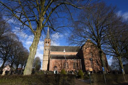
This section of the route leads across the Soestpolder, one of the polders drained by the local monks. The monumental Kruiskerk church that dominates the skyline in Burgum was the abbey church of the Canons Regular who founded the Barraconvent monastery in Burgum. Sadly nothing remains of the monastery. The last part of the walk takes you across the bridge over the Prinses Margrietkanaal and ends in Garyp, an old village situated on a sand ridge surrounded by peatland.
Sights on this route
Starting point
Oastein 1
9269 SB Feanwâlden
Navigate to starting point
De Schierstins Cultural History Centre
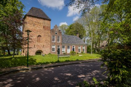
This unique building in Feanwâlden is the only freestanding medieval defence tower north and east of the river IJssel. Today it hosts historical and art exhibitions and a variety of cultural activities.

De Schierstins Cultural History Centre
De Schierstins Cultural History Centre
Hoofdstraat 1
9269 SW Feanwâlden
Soestpolder Nature Reserve
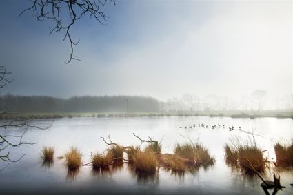
The man-made grasslands of the Soestpolder nature reserve are an important habitat for meadow birds. Other parts of the reserve attract water birds and waders, such as the Eurasian bittern, the bearded reedling and the great egret.

Kruiskerk Burgum
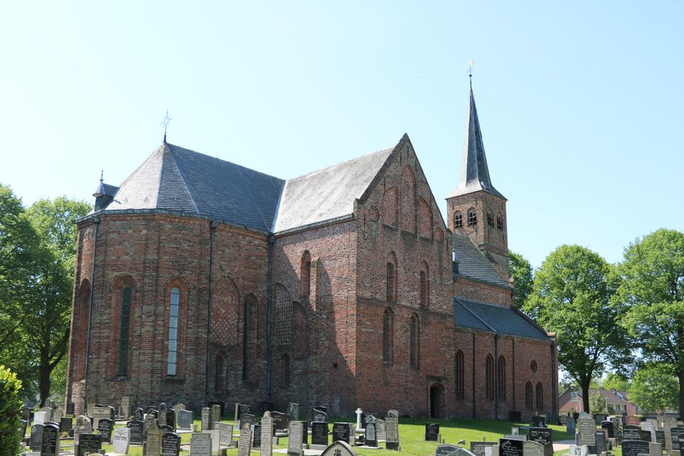
De Hervormde kerk van Burgum is in de 13e eeuw door de Reguliere Kanunniken in gebruik genomen als abdijkkerk. De romanogotische parochiekerk hoorde bij het naastgelegen Bergklooster.

End point
Tsjerkepaed 13
9263 PS Garyp
Navigate to endpoint
Directions
Van Feanwâlden (86) doorlopen naar knoopunten 75 - 61 - 78 - 59 - 52 - 41).
Einde Oostersingel rechtsaf naar Rijksstraatweg en linksaf naar Zomerweg (47), linksaf naar Miensker (zandpad).
(21) Pad door de Soestpolder om waterplas heen (28) en aan einde rechtsaf overstap, vervolgens pad volgen door polder.
Ter hoogte van gaslocatie (22) rechtsaf en op Nieuwstad linksaf (34) naar Kruiskerk (53). Door Schoolstraat (58), linksaf Lagerweg, einde rechtsaf vervolgens linksaf na gemeentehuis (52) brug over Prinses Margrietkanaal, daarna linksaf en talud af naar fietspad onder brug door, na bocht rechtsaf (57) en vervolgens 33 naar 14 - 37 - 31.
Op Unicumplein rechtsaf Tsjerkepaad, vervolgens linksaf over Lytse Buorren terug naar centrum.
- 86
- 75
- 61
- 78
- 59
- 52
- 41
- 47
- 21
- 28
- 22
- 34
- 53
- 58
- 52
- 57
- 33
- 14
- 37
- 31
